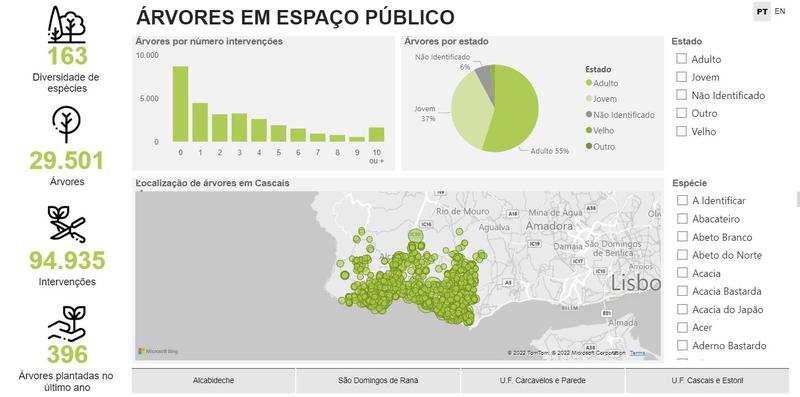
Cascais data – Ambiente & Energia– dashboard temático
Visualización
Published on 15 de septiembre de 2021 by Câmara Municipal de Cascais

Órgão da administração local do concelho de Cascais.
ID dataset: AE13 Descritivo: Cadastro das árvores em espaço público urbano - localização e características (espécie, nome científico e estado). Georreferenciação? Sim. Projeção cartográfica: WGS84. Período temporal: julho 2021 a setembro 2024 | Última atualização dos dados: 04-10-2024 | Periodicidade de atualização: mensal. Se detetou alguma anomalia ou pretende deixar uma sugestão para melhoria do conjunto de dados, faça-nos chegar a sua avaliação: https://forms.office.com/r/G5dswwYrzw - - - - - - - - - - Description: Registration of trees in urban public space - location and characteristics (species, scientific name and condition). Georeferencing? Yes. Map Projection: WGS84. Time frame: July 2021 to September 2024 | Last updated data: 04-10-2024 | Periodicity of update: monthly.
You have built a more comprehensive database than those presented here? This is the time to share it!
Explore the reuses of this dataset.
Did you use this data ? Reference your work and increase your visibility.
Visualización
Published on 15 de septiembre de 2021 by Câmara Municipal de Cascais

Discussion between the organization and the community about this dataset.